54 · City guide
Sakarya
Lakes, floodplain forests, the Black Sea
Sakarya stretches across the broad plain of the river that gives it its name, between the Samanlı and Kapıorman mountains and the Black Sea coast. Sapanca Gölü (Lake Sapanca) and Poyrazlar Gölü are nature escapes right next to the city; in the north, the Acarlar Longoz is Türkiye's largest flooded forest. The bridge commissioned by Emperor Justinian in the 6th century shows the region's importance on the road linking İstanbul to Anatolia. To the south, Taraklı, with its wooden mansions, boxwood spoons and calm pace of life, is a member of the Cittaslow network. Doğançay Waterfall, the Kuzuluk hot springs and the Acelle, Çiğdem and Karagöl yaylas (highland pastures) show the cool side of the interior, while the beaches of Karasu and Kocaali offer the Black Sea in summer. The cuisines of Caucasian and Balkan immigrants and Islama köfte are the signature of the Sakarya table.
Machine translated — This content was machine-translated and may differ from the original Turkish text.28
Places
0
Routes
0
Badges
Where shall we explore?
 Machine translated — This content was machine-translated and may differ from the original Turkish text.
Forest
Acarlar Longoz
Karasu, Sakarya
Türkiye's largest longoz (floodplain) forest, stretching between Karasu and Kaynarca, and an important bird habitat.
 Machine translated — This content was machine-translated and may differ from the original Turkish text.
Yayla (highland pasture)
Acelle Yaylası
Akyazı, Sakarya
A cool yayla south of Akyazı, among coniferous and broadleaf forests, crossed by the Enişte Deresi.
 Machine translated — This content was machine-translated and may differ from the original Turkish text.
Birdwatching site
Akgöl (Ferizli)
Ferizli, Sakarya
A quiet natural lake north of Ferizli, formed behind the Black Sea coastal dunes.
 Machine translated — This content was machine-translated and may differ from the original Turkish text.
Museum
Ali Fuat Paşa Kuvâ-yı Milliye Museum
Geyve, Sakarya
A museum in the building used as headquarters by Ali Fuat Paşa, commander of the Western Front in the War of Independence.
 Machine translated — This content was machine-translated and may differ from the original Turkish text.
Mosque
Büyükesence Orhan Mosque
Erenler, Sakarya
A mosque in Büyükesence village in Erenler, known by the name of Orhan Gazi and regarded as one of the oldest Ottoman buildings in the region.
- Machine translated — This content was machine-translated and may differ from the original Turkish text.
Yayla (highland pasture)
Çiğdem Yaylası
Hendek, Sakarya
A yayla at about 1,400 meters in the Elmacık Mountains, carpeted with crocuses in spring and autumn.
 Machine translated — This content was machine-translated and may differ from the original Turkish text.
Natural monument
Doğançay Waterfall
Geyve, Sakarya
A waterfall foaming down in five steps, protected as a natural monument and laid out with a picnic area.
- Machine translated — This content was machine-translated and may differ from the original Turkish text.
Canyon
Harkköy Canyon
Taraklı, Sakarya
A canyon north of Taraklı, near Harkköy, formed by a stream flowing between steep rock walls.
 Machine translated — This content was machine-translated and may differ from the original Turkish text.
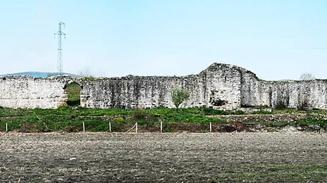
Castle
Harmantepe Castle
Adapazarı, Sakarya
A 12th-13th-century Byzantine castle on a small hill on the Adapazarı Plain, on the Söğütlü boundary; the most intact Byzantine castle in Sakarya.
 Machine translated — This content was machine-translated and may differ from the original Turkish text.
Bridge
Bayezid II Bridge (Geyve)
Geyve, Sakarya
A multi-arched Ottoman stone bridge over the Sakarya River, built in the reign of Bayezid II.
 Machine translated — This content was machine-translated and may differ from the original Turkish text.
Bridge
Justinian Bridge (Beşköprü)
Serdivan, Sakarya
A monumental stone bridge about 430 meters long, built over the Sakarya River in the 6th century by the Byzantine Emperor Justinian I.
 Machine translated — This content was machine-translated and may differ from the original Turkish text.
Yayla (highland pasture)
Karagöl Yaylası
Taraklı, Sakarya
A yayla northeast of Taraklı, surrounded by a pond and pine forests, offering a cool summer getaway.
 Machine translated — This content was machine-translated and may differ from the original Turkish text.
Castle
Karasu Castle
Karasu, Sakarya
The remains of a medieval castle on the hill south of Karasu, overlooking the Black Sea coast and the plain.
 Machine translated — This content was machine-translated and may differ from the original Turkish text.
Beach
Karasu Coast
Karasu, Sakarya
A seaside town on Sakarya's Black Sea coast, known for its fine-sand beaches stretching for kilometers.
 Machine translated — This content was machine-translated and may differ from the original Turkish text.
Beach
Kocaali Coast
Kocaali, Sakarya
The Kocaali shore, with a natural sandy beach about 14 km long and lilies along the seafront.
 Machine translated — This content was machine-translated and may differ from the original Turkish text.
Hot spring
Kuzuluk Hot Springs
Akyazı, Sakarya
A thermal settlement south of Akyazı, known for its healing hot waters, next to a forest nature park.
 Machine translated — This content was machine-translated and may differ from the original Turkish text.
Castle
Paşalar Castle (Karaceyş Castle)
Pamukova, Sakarya
The remains of a castle on a hill commanding the Pamukova and Geyve plains, thought to have been built in the Byzantine period and taken by the Ottomans in 1314.
 Machine translated — This content was machine-translated and may differ from the original Turkish text.
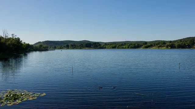
Nature park
Poyrazlar Gölü Nature Park
Adapazarı, Sakarya
A natural lake north of Adapazarı surrounded by ash and alder forest, known for its walking track.
- Machine translated — This content was machine-translated and may differ from the original Turkish text.
Mosque
Rüstem Paşa Mosque (Sapanca)
Sapanca, Sakarya
The mosque surviving from the staging complex on the Istanbul–Baghdad road of Rüstem Paşa, grand vizier under Süleyman the Magnificent.
 Machine translated — This content was machine-translated and may differ from the original Turkish text.
Museum
Sakarya Earthquake Museum
Adapazarı, Sakarya
A museum founded to raise earthquake awareness in Adapazarı, which was heavily damaged in the 1999 Marmara earthquake.
 Machine translated — This content was machine-translated and may differ from the original Turkish text.
Museum
Sakarya Museum
Adapazarı, Sakarya
A museum in central Adapazarı displaying the province's archaeological finds and ethnographic artifacts.
 Machine translated — This content was machine-translated and may differ from the original Turkish text.
Lake
Sapanca Gölü (Lake Sapanca)
Sapanca, Sakarya
A freshwater lake surrounded by forests at the foot of the Samanlı Mountains; a beloved Marmara getaway for its lakeside road and sunsets.
- Machine translated — This content was machine-translated and may differ from the original Turkish text.
Mosque
Şeyh Muslihiddin Mosque
Kaynarca, Sakarya
A wooden mosque in Kaynarca built in 1486, in the reign of Bayezid II, using the çantı technique without a single nail.
 Machine translated — This content was machine-translated and may differ from the original Turkish text.
Castle
Seyifler Castle
Ferizli, Sakarya
Castle remains thought to date from the Byzantine period, on a hill in Seyifler village in Ferizli.
 Machine translated — This content was machine-translated and may differ from the original Turkish text.
Monumental tree
Taraklı Historic Plane Tree
Taraklı, Sakarya
A monumental plane tree rising within Taraklı's historic fabric, its age estimated to go back centuries.
 Machine translated — This content was machine-translated and may differ from the original Turkish text.
Historic street and neighborhood
Taraklı Historic Houses and Bazaar
Taraklı, Sakarya
Streets of wooden Ottoman mansions, handicraft shops and a historic bazaar in Taraklı, a member of the Cittaslow network.
 Machine translated — This content was machine-translated and may differ from the original Turkish text.
Lake
Taşkısığı Gölü (Lake Taşkısığı)
Adapazarı, Sakarya
A quiet lake north of Adapazarı formed in an old bed of the Sakarya River, with reed beds and waterbirds.
 Machine translated — This content was machine-translated and may differ from the original Turkish text.
Mosque
Yunus Paşa (Kurşunlu) Mosque
Taraklı, Sakarya
A 16th-century mosque in Taraklı commissioned by Yunus Paşa, grand vizier of Selim I, known for its lead-covered dome.
Practical information
Machine translated — This content was machine-translated and may differ from the original Turkish text.- Safety
- Rip currents on the Black Sea coast are dangerous; swim only in areas with lifeguards
- Climate
- Mild and rainy; Black Sea climate on the coast, Marmara climate inland
- Best season
- April–June and September–November; July–August for the sea
- Getting there
- Arifiye/Sapanca stops on the İstanbul–Ankara high-speed rail line; Adaray suburban train between Adapazarı and Arifiye; TEM and D-100 highways