Nature / Waterfall
Muradiye Waterfall
Muradiye, Van
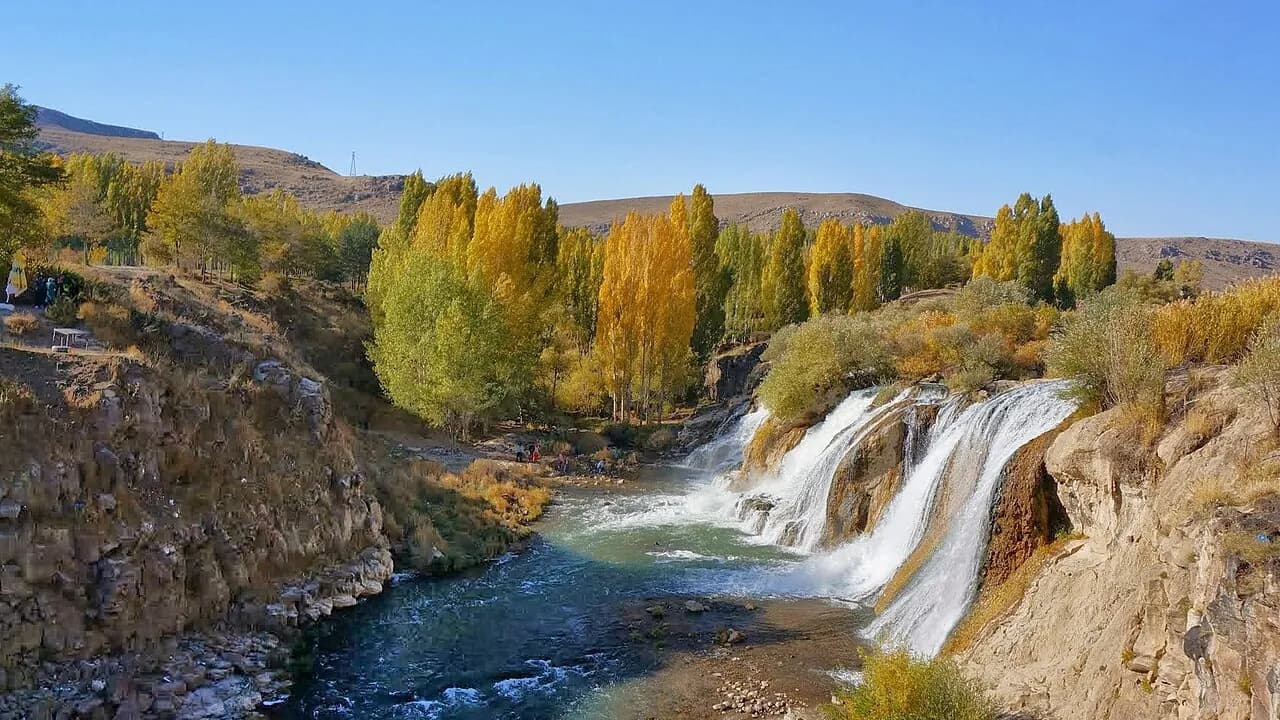
Van's most visited waterfall, where the Bendimahi Çayı drops 18 meters over a basalt ledge, with its green surroundings and waters that freeze in winter.
Safety warning
Its story
About 8 km north of the Muradiye district center, the Bendimahi Çayı, coming from the Çaldıran Plain, forms this waterfall as it passes through the narrow, deep Gönderme Gorge to reach the Muradiye Plain. The water falls from different heights over a young volcanic basalt mass; the highest drop is 18 meters in the middle and 15–16 meters at the sides. It is said to take its name from Sultan Murad IV, who passed through the area during the Baghdad campaign. The vegetation around the waterfall is also protected. In some winters the waterfall freezes into a white, stepped sheet of ice. There is a viewing area beside the waterfall; in Muradiye you can also see the Şeytan Köprüsü (Devil's Bridge) and the Bendimahi Bridge.
Key facts
- Height
- ~18 m
- Getting there
- Van–Doğubayazıt road, ~8 km north of Muradiye
- Visit duration
- 45 minutes
Trip purpose
- Photography
- Day trip
- Traveling with kids
Location
39.05665, 43.75677
Where to eat nearby
No food & drink venues listed nearby.
Map data: © OpenStreetMap contributors; Overture Maps
Reviews
No approved reviews yet. Reviews are written in the app after a visit.
Source: Web derlemesi (doğrulanmalı): https://tr.wikipedia.org/wiki/Muradiye_Şelalesi | https://tr.wikipedia.org/wiki/Bendimahi_Çayı | https://van.ktb.gov.tr/TR-437305/muradiye.html | https://van.ktb.gov.tr/TR-437066/korunan-alanlar.html | https://www.openstreetmap.org/node/2148113269