
Göbeklitepe – Karahantepe – Harran
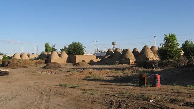
A driving route from the Neolithic to the Middle Ages: Göbeklitepe, a UNESCO heritage site dating to around 9600 BC, its contemporary Karahantepe in the Tek Tek Mountains, then in Harran the ancient mound with the ruins of the Ulu Mosque (Grand Mosque), considered the oldest mosque in Anatolia, and the beehive houses with their conical domes.
- Estimated duration
- ~7 h
- Straight-line distance (estimate)
- ~72 km
- Getting around
- By car
- Stops
- 4 stops
Duration and distance are estimates. Distance is the straight-line sum between stops; the actual road is longer. Check with a maps app before you set off.
Safety and caution
Route map
Numbers show the order of stops; the dashed line is a straight-line link between stops, not the actual road.
Map data © OpenStreetMap contributors (ODbL).
Stops
- 1
- 2
~37 km from the previous stop (straight line)

Mound (höyük)
Karahantepe
Haliliye, Şanlıurfa
~36.87 km from the previous stop as the crow flies
View place - 3
~35 km from the previous stop (straight line)

Archaeological site
Harran Archaeological Site and Harran Ulu Mosque
Harran, Şanlıurfa
~34.9 km from the previous stop as the crow flies
View place - 4
~370 m from the previous stop (straight line)
Architecture
Harran Beehive Houses (Kümbet Evleri)
Harran, Şanlıurfa
~0.37 km from the previous stop as the crow flies
View place

More routes in Şanlıurfa
See all Waterside and historyMachine translated — This content was machine-translated and may differ from the original Turkish text.
Şanlıurfa
Halfeti and Birecik: the banks of the Euphrates
A route along the Euphrates: a boat tour and stone houses in Halfeti, partly submerged by the waters of the Birecik Dam, then Birecik Castle, also called the 'White Castle', and the Birecik Ulu Mosque (Grand Mosque) dated 1365.
3 stops ~3 h 45 minMixed Culture and faithMachine translated — This content was machine-translated and may differ from the original Turkish text.
Şanlıurfa
A day in Şanlıurfa: Balıklıgöl and the bazaar
A walk from the museums to the bazaar: the Archaeology and Mosaic Museum with its Göbeklitepe finds, Haleplibahçe with its 'Amazons Hunting' mosaic, Balıklıgöl with its sacred carp, the Halil-ür Rahman Mosque, the cave where the Prophet Abraham (Hz. İbrahim) is believed to have been born, and the 16th-century Gümrük Han with the covered bazaar.
6 stops ~6 hWalking